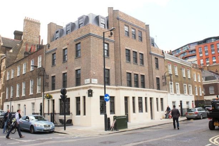
19 Percy Road London e111aj

description
Summary
remarks
conditions
| Type of Investment |
|
| Property Term | Freehold |
| Type of sale | Private |
| Ground Rent | £ 6,000 |
| Property Type | Apartment |
| Renewable Leash | Yes |
| Contract Terms | Sole Agent |
| Available From | 30/12/23, 17:43 |
| Garages | 1 |
| Cross Streets | |
| LocalAuthority | London |
| Floors | Carpet - Ceramic Tile |
| Plumbing | Full Copper Plumbing |
| Enviroment Warnings | Current | Potential |
|---|---|---|
|
Very environmentally friendly - lower CO2 emissions 
Not environmentally friendly - higher CO2 emissions |
| Energy Efficient | Current | Potential |
|---|---|---|
|
Very energy efficient - lower running costs 
Not energy efficient - higher running costs |
Stamp duty rates have increased for anyone purchasing an additional property. From April 2016 a 3% surcharge has been applied on top of the normal SDLT rate.
New rates, exemptions and examples can be found on our buy to let stamp duty and SDLT for second homes pages.
Stamp duty for most first time buyers has been permanently abolished. For qualifying criteria, calculations and rates please visit our stamp duty for first time buyers page.
Land and Buildings Transaction Tax (LBTT) has replaced stamp duty in Scotland. For more information, calculations and rates please visit our LBTT calculator page.
From April 2018 Land Transaction Tax (LTT) has replaced stamp duty in Wales. For the latest LTT information, rates and calculations please visit our LTT calculator section.
| Tax Band | % | Taxable Sum | Tax |
|---|---|---|---|
| less than £300k | 0(2/5)* | £0 |
£0 |
| £300k to £500k | 5 | £0 |
£0 |
| £500k to £925k | 5 | £0 |
£0 |
| £925k to £1.5m | 10 | £0 |
£0 |
| rest over £1.5m | 12 | £0 |
£0 |
| Tax Band | % | Taxable Sum | Tax |
|---|---|---|---|
| less than £125k | 0 | £0 |
£0 |
| £125k to £250k | 2 | £0 |
£0 |
| £250k to £925k | 5 | £0 |
£0 |
| £925k to £1.5m | 10 | £0 |
£0 |
| rest over £1.5m | 12 | £0 |
£0 |
| Effective Rate |
| Tax Band | % | Taxable Sum | Tax |
|---|---|---|---|
| less than £125k | 3 | £0 |
£0 |
| £125k to £250k | 5 | £0 |
£0 |
| £250k to £925k | 8 | £0 |
£0 |
| £925k to £1.5m | 13 | £0 |
£0 |
| rest over £1.5m | 15 | £0 |
£0 |
| S.No | Points Analyzed | Radius | Average | 70pc Range | 80pc Range | 90pc Range | 100pc Range |
|---|---|---|---|---|---|---|---|
| 1 | 20 | 0.16 | 510000 | 400000,900000 | 375000,1050000 | 325000,1125000 | 245000,1350000 |
| S.No | Status | postcode | postcode_type | council | council_rating | year | band_a | band_b | band_c | band_d | band_e | band_f | band_g | band_h |
|---|---|---|---|---|---|---|---|---|---|---|---|---|---|---|
| 1 | success | Waltham Forest | 2023/24 | 1,370.37 | 1,598.76 | 1,827.16 | 2,055.55 | 2,512.34 | 2,969.13 | 3,425.92 | 4,111.10 |
| S.No | Status | radius | population | crimes_last_12m | crimes_per_thousand | crime_rating | Anti-social behaviour | Burglary | Violence and sexual offences | Vehicle crime | Other theft | Bicycle theft | Criminal damage and arson | Public order | Shoplifting | Drugs | Robbery | Theft from the person | observations | process_time |
|---|---|---|---|---|---|---|---|---|---|---|---|---|---|---|---|---|---|---|---|---|
| 1 | success | 0.41 | 12336 | 1280 | 104 | Low crime | 252 | 43 | 339 | 160 | 121 | 18 | 58 | 86 | 51 | 57 | 27 | 45 | Incidence of Criminal damage and arson is below national average,Incidence of Theft from the person is above national average,Incidence of Vehicle crime is above national average | 1.59 |
| S.No | Status | Postcode | Postcode Type | Total for sale | Average Sales | Turnover month | Month Inventory | Dayson Market | Demand Rating | Process Time |
|---|---|---|---|---|---|---|---|---|---|---|
| 1 | success | E11 1AJ | full | 33 | 9 | 27% | 3.7 | 113 | Seller's market | 3 |
| S.No | Status | postcode | postcode_type | radius | url | deprivation | health | ab | c1 | c2 | de |
|---|---|---|---|---|---|---|---|---|---|---|---|
| 2 | success | E11 1AJ | full | 0 | https://propertydata.co.uk/draw?input=E11+1AJ | 9 | 50 |
| S.No | Year | Value | Percentage |
|---|---|---|---|
| 1 | May 2018 | 469662 | |
| 2 | May 2019 | 497500 | 5.9% |
| 3 | May 2020 | 525736 | 5.7% |
| 4 | May 2021 | 508277 | -3.3% |
| 5 | May 2022 | 553887 | 9.0% |
| 6 | May 2023 | 571759 | 3.2% |
| S.No | Status | postcode | postcode_type | url | constituency | constituency_code | eventname | labour | conservative | liberaldemocrat | green | brexit | process_time |
|---|---|---|---|---|---|---|---|---|---|---|---|---|---|
| 1 | success | E11 1AJ | full | https://propertydata.co.uk/draw?input=E11+1AJ | Leyton and Wanstead | E14000790 | General Election 2019 | 28836 | 8028 | 4666 | 1805 | 785 | 0.10 |
| S.No | Points Analyzed | Radius | Unit | Average | 70pc Range | 80pc Range | 90pc Range | 100pc Range |
|---|---|---|---|---|---|---|---|---|
| 1 | 20 | 0.14 | 613350 | 355000,850000 | 342000,925000 | 305000,1050000 | 285000,1250000 |
| S.No | Points Analyzed | Radius | Gross yield |
|---|---|---|---|
| 1 | 40 | 0.34 | 3.8% |
22, PERCY ROAD
13, PERCY ROAD
14, PERCY ROAD
16, PERCY ROAD
16A, PERCY ROAD
15, PERCY ROAD
6, PERCY ROAD
19, PERCY ROAD
FLAT 1, 11, PERCY ROAD
8, PERCY ROAD
4, PERCY ROAD
FLAT 2, 11, PERCY ROAD
18, PERCY ROAD
1, PERCY ROAD
20, PERCY ROAD
10, PERCY ROAD
28, PERCY ROAD
5, PERCY ROAD
21, PERCY ROAD
17, PERCY ROAD
7, PERCY ROAD
3, PERCY ROAD
24, PERCY ROAD
9, PERCY ROAD
26, PERCY ROAD
2, PERCY ROAD
30, PERCY ROAD
2A, PERCY ROAD
| Property Type | Estimation price |
| flat | 1700000 |
| detached_house | 1650000 |
| flat | 1500000 |
| detached_house | 1350000 |
| flat | 3300000 |
| flat | 1950000 |
| detached_house | 2375000 |
| flat | 3575775000 |
| flat | 298100000 |
| flat | 206350000 |
| detached_house | 207350000 |
| terraced_house | 292475000 |
| semi-detached_house | 234500000 |
| flat | 369475000 |
| flat | 3300000 |
| flat | 2650000 |
| flat | 3300000 |
| Property Type | Estimation price |
| flat | 1145 |
| detached_house | 718 |
| flat | 1026 |
| detached_house | 604 |
| flat | 2099 |
| flat | 1295 |
| detached_house | 995 |
| flat | 117092 |
| detached_house | 103744 |
| terraced_house | 147402 |
| flat | 2229 |
| flat | 1809 |
| flat | 2142 |